Friday, January 23, 2009

Antenna connectors and creme brulee

And when is a solder joint on a coax cable going to fail? Of course in the harshest period of winter, with at least a foot of snow on the ground and temperatures in single digits at mid-day!

And how do you solder a connector that can't be taken off the antenna without taking the entire antenna down? Well, I waited for a day that was not windy and no snow was in the forecast for that day either. I got my lightweight aluminum stepladder out on the deck, set after having cleared most of the snow climebed up but the connector was still out of reach. Luckily my mast is set so I can lower it, at least to some degree by just releasing a few clamps. Easier said than done in those temperatures. Well, now I can reach the connector, but how can I solder it? My soldering iron is 25w at most, and that certainly won't cut it in a single digits environment. And bringing it up with an extension cord, on an aluminum ladder set on snow remnants? Not too smart, electrically speaking.

Then came the idea! A few years ago, my wife made creme brulee and all that was needed was to caramelize the topping. Much to my wife's horror, I brought my blowtorch and did my deed, without putting the kitchen on fire, which was what my wife had feared then. Later on we were given a mini-blowtorch, to be used uniquely for creme brulee...

Soldering with a blowtorch is something I reserve for plumbing jobs, not for coax connectors. But the mini blow torch might perhaps do the job. I gave it a try and within seconds, I had a nice shiny solder connection made, SWR was back to normal and all was for the best! No apparent damage was done to the plastic shield. I guess the air temperature was working for me at that point.

So here it is, without the sweet smell of the creme brulee and without the acrid smell of burnt plastic too!


Tuesday, January 20, 2009

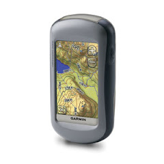
Comparing sensors in a Garmin Oregon 400i, a Garmin 60CSx and the Yaesu VX-8

My house temperature was 65-66 degrees when I turned on my VX-8 and the sensor registered 77 degrees. Later on it got to 82 degrees. Well, that's the temperature inside the VX-8 so I guess some energy is converted to heat, and I was not transmitting. So all I can say, the VX-8 would make a dismal rectal thermometer... But if you want to know how hot it is in the unit, well I guess the number is in the ballpark.

Altitude:
I compared three instruments, a Garmin 60CSx GPS, a Garmin Oregon 400i and the VX-8. I looked at both GPS and barometric altitudes.


Barometric altitude
GPS altitude
Garmin 60CSx 1072
1069
Oregon 400i
1081
1079
Yeasu VX-8
1092
1030

Measurements were taken in a single location (my living room) at about the same time, meaning very little change in the GPS constellation. The Garmin units show consistency and a difference of 9-10 feet. The VX-8 is in the ballpark but the GPS altitude is not as good. According the the topo map the altitude is 1055. Since I was not in the basement, maybe I need to add 8-10 feet or so and the map contour lines definitely predate the house...

My conclusion is not to try to land a plane using any of these three instruments only... Otherwise, gosh, it is good enough for me.

I also checked the GPS' precision in location and here the news are excellent! The table below shows the decimal part of the minutes in both longitude and latitude numbers, all in WGS 84 datum.

Garmin Oregon 400i and 60CSx
Yaesu VX-8
,758
.765
.878
.874

Now, this is only anecdotal data, a single measurement in the comfort of my living room, not taken in any extreme type of weather and conditions. But for me it is good enough.

Monday, January 19, 2009

Balloons, balloons!

Balloons are fun! Fun to blow with the pump and fun to release!

Drew takes the lead!


Geoff, balloonist par excellence!


Olivia, the balloonist's apprentice!

Sunday, January 18, 2009

Playing board games.

Well, all the family was here this weekend and this is first attempt at imbedding a video from youtube. Enjoy! I'll add more in the days to come, maybe also a slide show.


Tuesday, January 13, 2009

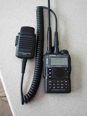
My new Yaesu VX-8R radio/APRS

This is my new Yaesu VX-8R radio, A small but rugged and waterproof handheld which has a built-in GPS chip in its speaker mike and not only displays my location (in lat/long, WGS 84) on its screen, but can also send it via APRS, to the entire world, given it can reach an internet gate (i-gate).

If its transmissions make it to an i-gate, my position can be checked on several websites including my own K9CHP. Just scroll down to the Where am I page.

But even if I am truly hiking in the boonies, my VX-8R can transmit my position to my truck where it will be kept both on the Kenwood TM-700a mobile radio and the Garmin 60CS GPS. The TM-700a is now out of production and has been replaced by the RC-D710


Another possibility is to use my Kenwood TH-D7AG handheld radio that can be connected to my Garmin 60CSx GPS. This is the seup shown below. I trd using it in the field but the radio is fragile and not waterproof, so you have to protect it a lot and the connecting cable not only tends to get snagged but disconnects quite often, so the entire setup is of questionable field value. But it can be left at base and now they can have a precise idea of my whereabouts and anybody elxe using APRS in that area.

I can also connect the TH-D7AG/60CSx to a laptop and have the locations appear on screen. But the software I use needs internet connection to work at its best, so it won't be functional everywhere. The TH-D7AG is now out of production.


And here you can see how my location looks like on the GPS screen. The blue flag is the last waypoint received. I did change the scale to a large display so the new waypoint will be distinct from the existing ones. But even if it is not clear enough on screen, find waypoints near current location will give the desired results.

I hope to put the system into use in SAR training with Eagle Valley Search Dogs. The nice thing is that the VX-8R can be used by a person without an Amateur Radio licence as it is a simple remote APRS beacon and I will be its control operator. The person carrying it will not have access to any function other than turning the unit off, if so requested on our SAR network.

Monday, January 12, 2009

K9 SAR training with Eagle Valley Search Dogs

January 10th counts as a winter day in my book. With a predicted winter storm coming from the west, I expected some wind at least at ground level. Nada, zip, nothing. Yes the winter storm came from the west and it snowed, enough to make driving next to impossible in the late afternoon/evening but at ground level, not even a flake was drifting, showing no significant air movement at ground level! Makes things kind of hard for the dogs to work as the scent cones do not develop much.

I gave my Kahtoola Microspikes a workout in the am and they worked like a charm. I did not slip once for lack of traction. Some teammates complained that they can ide up, so next time I'll use some show sheen on them and see if that helps. The snow we were on was on top of a layer of ice and snowshoes maybe would have prevented breaking through that ice, as it happened

In the pm, I used my snow shoes, but this time, the snow was not that deep, no ice under it and too many logs to block my way. I would have been better off with the Kahtoola Microspikes. Go figure!

My Oregon 400i GPS also caused some havoc as suddenly I could not see my topo map on the screen. For whatever reason, when I switched it perhaps back to the K9 SAR profile, it worked fine thereafter. There is also a possibility that I inadvertently switched the scale of the map, difficult to say, as the cold can cause butterfigeritis. Anyhow, I was happy to be able to solve the problem on the fly.

As for Stryder, he did ok. The hide Kyle had chosen was a bear, well almost a bear's den. The subject got inside that natural ledge so deep he could not be seen from outside. I got there by sheer luck as my search plan got shredded from the beginning, as the area I was given and the area I had on my GPS were not matching at all! So after I took Kyle's GPS and started working it and trusting it (that took me about 10 good minutes as I had to clear the mental picture I had built in my head and replace it with what that GPS was telling me). I got to the corner of my area and decided to do a pass in the middle of my area, mostly following contour lines. That's where I got close to the cache. I then saw the footprints. Stryder did not alert yet, he even poked his nose in the cache but did not indicate yet. He worked the scent, got on top of the rocks where scent was probably escaping up. Stryder now had his natural alert, came back towards me got under the ledge and did his refind, bumping my right hand.

Had I not seen the tracks, I am not sure Stryder would have gotten his subject, as we passed close to him a little higher and he did not show any scent acquisition, yet the scent was going up from the mini-cave at least at first. Would he have gotten scent farther below, where un-energized scent tends to go? How far would the scent have gone? These questions will remain unanswered.

Monday, January 5, 2009

Sonar SAR K9, like a cruise missile, fast and accurate


Sonar is working a scent source located towards the close end of the gutter. This is the way she indicated on sources that were up, beyond her reach.


Here is Sonar in an actual search, checking the shore of the Grasse River near Canton NY. Sonar was a superb search dog and cadaver dog. Unfortunately she blew an ACL in training in Montana, and despite surgery, she never recovered completely so I had to retire her. She is now enjoying the couch at home.

Sunday, January 4, 2009

Radar, SAR K9 extraordinaire


This is Radar, sporting his New York State Senate Liberty Award he earned for his work in 9-11 at the recovery detail in Fresh Kills, Staten Island, NY.

Radar was raised and certified in the US, then both Radar and Chip went with me to Israel for a year and a half as I was taking care of my ailing mother. We also participated in a few searches in Israel, one particularly memorable as it was in the Judean Desert, near the Dead Sea, the lowest point on earth. That search did not have a good outcome as the victim was found deceased, about 10 miles out of that area.

We, Chip Radar and I, then returned to the US and were asked to participate in the mission to Australia with the 1st Special Response Group (1SRG).


That search in the Great Sandy Desert of Western Australia sure made headlines, especially when the subject was found after having spent forty days in the unforgiving desert! Other than 3 very skilled K9s, 1SRG also had, IMO the best visual mantracker there is in SAR, Joel Hardin. All these special skills in addition to the team's resourcefulness contributed greatly in the desired result.


This is a picture that not very many cas take. We were searching for a suicide victim in the gorge of the Genesee River in Letchworth State Park NY. We were give special permisssion to search the upper part of the river, where no visitors are allowed and had to cross the river not far from the falls in the background, to check a ledge with caves where the body could have been lodged in high waters. I worked both Chip and Radar, together, as I had trained them to work like that. They did well even in the canoe that transported us from place to place. The water was so shallow that we did not have to search it, just get the canoe through. But we stopped and searched areas that had been under water during the winter and early spring.


This picture was taken during Radar's water search certification. Radar was always meticulous in his alerts, precise till he jumped in, only in calm waters though, and the scent sourde was always there, where he indicated!


This was Radar's largest water search, off City Island, NY. There were four victims and despite two dogs giving trained indications the divers never found the bodies on the silty bottom. All four bodies were recovered later on as they re-floated. This search was a first as we used new technologies, search patterns planned on a laptop computer and transfered to GPS, then implemented. Alerts and trained indications were saved as waypoints then later analysed, on location, to see where the next effort should go.

Saturday, January 3, 2009

Chip my first SAR dog


This is Chip or formally known as Can OTCh. Amir's Tollhouse Morsel Am. UDT, Search and Rescue K9, Super UD Award winner and many other titles.

Chip is the dog that started it all, who taught me so much and who had direct and indirect influence on my other SAR dogs, Radar, Sonar and Stryder.


Chip has always loved the water and water searching has perhaps been his favorite specialty. Chip here shows how accurate his nose was and how readable his alert had become over time.

Friday, January 2, 2009

Worked All States (WAS)


Working a two-way contact with each one of the fifty states of the Union was a goal I set to myself after I upgraded to General. Contacts seemed to be easy to make at first. Then came the realization that having made the contact is just part of the job and it needed to be followed up by a QSL card. Envelopes, stamps, return address stickers, address sticker in addition to filling the QSL card (I still prefer filling them manually to putting a sticker on them too), all that amounts to a lot of work that took me away from the radio itself. Then I discovered ARRL's Logbook of the World, LoTW. After sending in my full log, I was nicely suprized with quite a lot of confirmed QSLs. Then Stephen Genusa came up with Ham Radio Deluxe Utilities and that practically automated the process with my logging program, Simon Brown's Ham Radio Deluxe. Now I just had to make contacts and hope they will log it on LoTW. There were a few states that eluded me for some time, Alaska, till I got my new antenna, the Cushcraft MA5B. Then came some western states such as Nevada and the mid-west as in North and South Dakota. For whatever reason, the entire north east was never heard till the day of a contest where I got all these missing states, including Delaware and Rhode Island in one weekend! Now I knew I had contacts with all fifty states and just needed to wait for the confirmations. The mailcarrier brought some, LoTW brought most. I ended up with 33 LoTW contacts and 17 QSL cards. The last card, the one from Rhode Island, came in just a few days before Christmas. I was ready, applied for the LoTW part on line, made the payment, printed the forms, and mailed them and my cards the very same day. The ARRL Awards Desk was wonderful and I got my WAS certificate before the year was over! Talk about fast turnaround!

So here it is, now proudly hanging on my wall. And now it is turn to get serious on the DXCC, my first 100 contacts with distant entities.

From inverted V to plain ole W


Last winter, we had an ice storm and trees were covered with a nice layer of ice, well nice to the eye, but not to the tree, power lines etc. Fortunately the damage was minimal as we were lucky enough not to get too thick a layer. I use a Cobra Ultra-Lite antenna for HF and I took a few pictures of the change that occurred with the ice.

What normally is an inverted V shape, was now a plain ole W shape. Having never read about a W shaped antenna, I did not bother checking SWR nor attempted to operate with it in that shape. The counter weights I use to dampen the sway of my supporting trees did its job and the antenna survived the ordeal without problems and is still in use a year later. The picture shows only one leg of the W though. The antenna is 140 feet long, at about 35-40 feet high. It works fine in all bands, with a tuner of course. The internal tuner of my Icom 756ProIII does the job. Difficult to rotate though! It is currently used for 30-160 meters as my Cushcraft MA5B beam is doing a better job on 10-20 meters.