

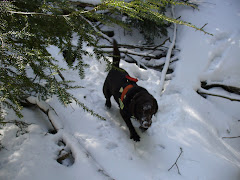

I have not been to the World Trade center since September 2001 when Radar, my search dog and I worked in Staten Island's recovery effort. I did not want to really see that huge hole in the ground. Having watched this video, I cannot wait now till the area is going to be open to the public.
Tuesday, July 27, 2010
Thursday, July 22, 2010
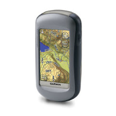
GPSMAP 62S vs. Oregon 400i
I got the 62S for two main reasons. With age, near sightedness is a problem, and it is hard to rely on reading glasses in the woods. So I needed a better display than my Oregon 400i could offer. While the 62S has a lower resolution than the Oregon 400i, that lower resolution seems to make it easier for me to read it, and the brightness of the display is helping too, so that problem (of mine) had been addressed.
The 3-axial compass is easy to calibrate, easier than my Droid Incredible, and once that done, it is a pleasure to use, no more trying to level things out. Beautiful. Compared between the two and my trusted Brunton Eclipse and had the same results, all three compasses indicating magnetic north where it should be.
I tested both units on the road near my house, a complete square shaped circuit, mostly in the open but the south side, especially on the outside of the road comes next to tall trees in full foliage. First time around, I walked on the inside, clockwise. The second time around, I walked on the outside, still clockwise and I reversed the GPS position.
At first, in the open, I noticed both units being very close in numbers, in single numbers even, sometimes just a foot away from each other, well they actually were, as I held one in each hand! But further down the separation grew to six feet, the 62S always being the best. I had WAAS acquisition, quite strong on both units, satellite 48. I lost it for a brief moment on the southern leg on the Oregon, but it came back. Now on the second time around, still on my east leg, I noticed the Oregon becoming less precise, much less so than the 62S. I also noticed the WAAS reception was not so good on the Oregon and it was on satellite 33, whereas the 62 was on 48. I lost WAAS on the southern leg on the Oregon, while I did not on the 62S. Precision went down to about 18ft on the 62S but was double that on the Oregon at nearly 40ft. I was watching the satellite screen all the time on both units.
So how do the track look and compare?
On the left, the Oregon 400i's screen and on the right the 62S.

 You can see that the scale is different as going to 120ft did not allow to have the entire picture on the 62S' screen.OTOH, on the Oregon at 200ft the two tracks almost blended, due to the higher resolution, I guess.
I would have been very pleased with either, as they show me on the correct side of the road, and this is not a major thoroughfare, mind you.
Look at the NW corner. On the outside, I had to decide when to cross the street and the way I crossed is better shown on the 62S than on the Oregon 400i. Looking at the SE corner, on the outside, I had to leave the edge of the road as it was overgrown there and the 62S shows it a bit better. Really, I am nit-picking, yet the 62 is the winner!
The maps displayed are not the same. The Oregon has Topo 2008 and NY 1:24000 topo that is displayed, whereas the 62S had the Garmin 1:24000 NE on a uSD card.
I will now put those tracks on an aerial in TopofusionPro and see if the win stays with the 62S.

OK, now we are talking magnification (click on the picture is you need to see it larger) and I see nothing further to add. The two units are darn good, with victory by points to the 62S because it tracked me more accurately in those corners and its WAAS fix was much more stable.
I was tempted to dig up files from the past, but then I remembered that GPS constellation would be different and also the GPS software and firmware would not be the same, thus introducing uncontrolled variables, so I'll stay away from that.
This is a work in progress, I'll add more as I do more. For now both units will accompany me in my forays, but I have a very sound feeling about the 62S. Scott from GPSFix fame told me he had tested the 60csx vs. the 62S and the display of the 62 is at least as good if not better than the 60csx because of the added colors. And his eyes are better than mine, I believe, certainly not as old.
I remembered I had a Gilsson external amplified antenna which I had not used since I got the Oregon. I found it nevertheless and since today is a rainy day, all I want to do is indoors testing. So here are the screens:


Left is with the Gilsson external amplified antenna, right naked 62S, same location, well read the UTM! I am indoors BTW. Location is as correct as I can place it on an enlarged aerial, altitude is right too, the only difference is the GPS precision circle and stronger reception of the satellites in general with the external antenna. Notice that WAAS is working fine (full bar with the external antenna) but I'm not far from a window. IMO, for SAR work, I don't see the need for the external antenna. I'll put it in/on my radio harness, to be used if conditions ever necessitate it, but not as routine use. I also noticed that the MCX connector is quite difficult to detach. I even used needle nose pliers.
Scott (GPSFix/wikis) had trouble transferring tracks adn Geocaches wirelessly. I tried too, from the Oregon 400i to the 62S and although both units indicated transfer completed 100%, I could not access these tracks on the 62S. Now upon checking via computer, I can see those files in the GPX folder! I have just restarted the 62S, still no-go! We may have a minor bug there!
The 62S at its worst!
I left my 62S on by my keyboard at my desk. I don't remember what I did check, but I forgot the unit on for just over an hour. Now my shack and computer are in the basement, facing a wall that is below ground. Behind me are stairs and the living room and only part of a window is visible, double pane glass, window treatment and behind it there is a huge tree in leaf. Most GPS units have no reception here, maybe if I hold them up so they have a better angle at the window and the satellite geometry is just right, but in most cases, I have no reception. Well, I have a track of 148 points, .52 miles long, my 62 being set at marking a point every 5 yards!
So here is the display on the 62S' screen:
 And here on TopoFusionPro:

Well I measured the total deviation, north-south was 70 meters and east-west was 50 meters.
Frankly, I've seen much much worse from earlier Garmin units. Why did my 62S do that, simply the signals from the satellite were bouncing all over the place, my below ground wall being just two feet from the 62S, as well as my desktop computer and HF radio and other ham gear. I always like to know how my equipment will function in extreme conditions and although I did no set up this test, the results are interesting and actually, IMO quite good. Tomorrow, I'll leave the 62S in outdoors for a hour and we'll be able to compare results. Satellite geometry will be different but the placement should give it quite an advantage.
OK, so today, I left the OR400i and the 62S on the table on my deck, is good position to acquire satellites for over an hour and a half. Here are the results:

 Screen size tell you which is the OR and which the 62S (ok the latter is on the left). Well, both did well, both in a 20ft diameter circle. Length of the "track" was different, maybe due to the extra sensitivity of the 62s' antenna? Now I did not take a screen dump of it but under a more normal working scale like 120, 200, etc. you can't even see that drift on the screen. Now for those of you who are looking for a 35mm film canister (Geocachers), you need to search for it in 314 square feet, a circle that has a radius of 10 feet.
The 3-axial compass is easy to calibrate, easier than my Droid Incredible, and once that done, it is a pleasure to use, no more trying to level things out. Beautiful. Compared between the two and my trusted Brunton Eclipse and had the same results, all three compasses indicating magnetic north where it should be.
I tested both units on the road near my house, a complete square shaped circuit, mostly in the open but the south side, especially on the outside of the road comes next to tall trees in full foliage. First time around, I walked on the inside, clockwise. The second time around, I walked on the outside, still clockwise and I reversed the GPS position.
At first, in the open, I noticed both units being very close in numbers, in single numbers even, sometimes just a foot away from each other, well they actually were, as I held one in each hand! But further down the separation grew to six feet, the 62S always being the best. I had WAAS acquisition, quite strong on both units, satellite 48. I lost it for a brief moment on the southern leg on the Oregon, but it came back. Now on the second time around, still on my east leg, I noticed the Oregon becoming less precise, much less so than the 62S. I also noticed the WAAS reception was not so good on the Oregon and it was on satellite 33, whereas the 62 was on 48. I lost WAAS on the southern leg on the Oregon, while I did not on the 62S. Precision went down to about 18ft on the 62S but was double that on the Oregon at nearly 40ft. I was watching the satellite screen all the time on both units.
So how do the track look and compare?
On the left, the Oregon 400i's screen and on the right the 62S.

 You can see that the scale is different as going to 120ft did not allow to have the entire picture on the 62S' screen.OTOH, on the Oregon at 200ft the two tracks almost blended, due to the higher resolution, I guess.
 I would have been very pleased with either, as they show me on the correct side of the road, and this is not a major thoroughfare, mind you.
Look at the NW corner. On the outside, I had to decide when to cross the street and the way I crossed is better shown on the 62S than on the Oregon 400i. Looking at the SE corner, on the outside, I had to leave the edge of the road as it was overgrown there and the 62S shows it a bit better. Really, I am nit-picking, yet the 62 is the winner!
The maps displayed are not the same. The Oregon has Topo 2008 and NY 1:24000 topo that is displayed, whereas the 62S had the Garmin 1:24000 NE on a uSD card.
I will now put those tracks on an aerial in TopofusionPro and see if the win stays with the 62S.

OK, now we are talking magnification (click on the picture is you need to see it larger) and I see nothing further to add. The two units are darn good, with victory by points to the 62S because it tracked me more accurately in those corners and its WAAS fix was much more stable.
I was tempted to dig up files from the past, but then I remembered that GPS constellation would be different and also the GPS software and firmware would not be the same, thus introducing uncontrolled variables, so I'll stay away from that.
This is a work in progress, I'll add more as I do more. For now both units will accompany me in my forays, but I have a very sound feeling about the 62S. Scott from GPSFix fame told me he had tested the 60csx vs. the 62S and the display of the 62 is at least as good if not better than the 60csx because of the added colors. And his eyes are better than mine, I believe, certainly not as old.
I remembered I had a Gilsson external amplified antenna which I had not used since I got the Oregon. I found it nevertheless and since today is a rainy day, all I want to do is indoors testing. So here are the screens:


Left is with the Gilsson external amplified antenna, right naked 62S, same location, well read the UTM! I am indoors BTW. Location is as correct as I can place it on an enlarged aerial, altitude is right too, the only difference is the GPS precision circle and stronger reception of the satellites in general with the external antenna. Notice that WAAS is working fine (full bar with the external antenna) but I'm not far from a window. IMO, for SAR work, I don't see the need for the external antenna. I'll put it in/on my radio harness, to be used if conditions ever necessitate it, but not as routine use. I also noticed that the MCX connector is quite difficult to detach. I even used needle nose pliers.
Scott (GPSFix/wikis) had trouble transferring tracks adn Geocaches wirelessly. I tried too, from the Oregon 400i to the 62S and although both units indicated transfer completed 100%, I could not access these tracks on the 62S. Now upon checking via computer, I can see those files in the GPX folder! I have just restarted the 62S, still no-go! We may have a minor bug there!
The 62S at its worst!
I left my 62S on by my keyboard at my desk. I don't remember what I did check, but I forgot the unit on for just over an hour. Now my shack and computer are in the basement, facing a wall that is below ground. Behind me are stairs and the living room and only part of a window is visible, double pane glass, window treatment and behind it there is a huge tree in leaf. Most GPS units have no reception here, maybe if I hold them up so they have a better angle at the window and the satellite geometry is just right, but in most cases, I have no reception. Well, I have a track of 148 points, .52 miles long, my 62 being set at marking a point every 5 yards!
So here is the display on the 62S' screen:


Well I measured the total deviation, north-south was 70 meters and east-west was 50 meters.
Frankly, I've seen much much worse from earlier Garmin units. Why did my 62S do that, simply the signals from the satellite were bouncing all over the place, my below ground wall being just two feet from the 62S, as well as my desktop computer and HF radio and other ham gear. I always like to know how my equipment will function in extreme conditions and although I did no set up this test, the results are interesting and actually, IMO quite good. Tomorrow, I'll leave the 62S in outdoors for a hour and we'll be able to compare results. Satellite geometry will be different but the placement should give it quite an advantage.
OK, so today, I left the OR400i and the 62S on the table on my deck, is good position to acquire satellites for over an hour and a half. Here are the results:

 Screen size tell you which is the OR and which the 62S (ok the latter is on the left). Well, both did well, both in a 20ft diameter circle. Length of the "track" was different, maybe due to the extra sensitivity of the 62s' antenna? Now I did not take a screen dump of it but under a more normal working scale like 120, 200, etc. you can't even see that drift on the screen. Now for those of you who are looking for a 35mm film canister (Geocachers), you need to search for it in 314 square feet, a circle that has a radius of 10 feet.
 Sunday, July 11, 2010
SAR training with Amigo SAR dogs
That was a pleasant event, a round robin of problems, enough to make you and your dog happy. We were lucky weather-wise as the hear spell got broken the day before and the heavy rains made way to a really nice day.
Training is also where I test my gear, in conjunction with working my dog. This time it was my new Droid Incredible and its topo mapping capabilities as well as track saving.
One thing I learned is to put the darn thing in airplane mode in areas with no reception. This will help the batteries last longer. This is the main problem with cell phones in general, they die due of lack of power in wilderness settings. I already have a power pack on order, one that can not only recharge the cell phone but be recharged itself by AC/12v and/or SOLAR! Now solar panels are not so efficient when moving, as most of us will try to stay in the shade, but when stationary, it can be directed towards the sun to be as efficient as possible.
The Droid Incredible has apps that can save your GPS track to the unit and can also share them by email (and other means) with friends or yourself, so you can then open the email attachment you sent yourself and import the track in your mapping software. While this app, MyTracks, is Google based, meaning road map and aerial, Gaia GPS beta gives you a nice USGS map, but it is quite a dated one. Looks terrific though till I looked at my Garmin Oregon 400i with its 24K maps on a memory card and the picture there was by far better, crisper, as long as the light was right, as the Oregon's display is not the best (acceptable but not great). Gaia GPS beta allows you to download map segments ahead of time, quite useful when going in no reception areas. My Tracks left me with a blank screen.
PICTURES: you can click on each picture to see an enlarged version.
Here is a screen view from Gaia GPS Beta on the Droid Incredible, as it has a share option, so I emailed it to myself:
 Below is a computer screen dump from MyTracks, this time I send the track to My Maps on Google Maps, so there is a way to share the tracks from the field, without a physical connection to the computer, if there is cell service.

I can make the Droid Incredible do most things My Oregon can do, but battery life and waterproofness are concerns. They can be overcomed but still, I prefer using a dedicated navigation GPS in the wilderness and save my battery on the Droid foir phone and pictures. OTOH, the ability to send tracks and photos is something to consider sometimes.
Below are two out of four photos taken of a "crime scene". 8-megapixels pictures that can be sent over the cell network and that ate geotagged, meaning the GPS location is encoded in the file and they can be placed on Google Earth for exact location!

 As you can see from the shadow, I'm standing and yet you can count every shell casing! From a phone camera!
And below is my Google Earth screen dump and you can see the geotagging information encoded in the picture.

Road navigation:
The Droid Incredible and my Garmin Nuvi 765T did well, but when I missed a turn, the Nuvi recovered and the Droid got stuck (maybe because of lack of phone reception, I don't know, as I was close to my destination and driving on a dirt road that needed my full attention. I was using the Droid on car power to conserve battery.
We also had a M+C course. After 18 years in SAR, my compass does not even have a scratch on it! Am I an armchair SAR searcher? Heck no, but simply my Brunton Eclipse developed a huge bubble so I sent it back to Brunton and a few days later, a brand new compass appeared at my doorstep. Hey, I sent an old, beat up compass and got a brand spanking new one in return. And now I know it works just fine in the woods! One leg was a GPS exercise (like Geocaching) and while I found a glitch in my GPS, I cannot reproduce it, yet, glitch or not, I used my unit and found the cache.
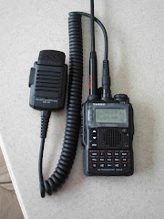
During one of the breaks from K9 work I took, waiting for an area to become available, I put my low power ham radio station together, radio, battery, antenna and counterpoise wire, in less than five minutes I was on the air, hearing a lot of European stations (there was a contest going on) and managing to make a contact with a Florida station, working 5 watts, just like a portable radio! SAR, K9-SAR and my ham radio hobby all at once! Life is good!
With all this going on, Stryder, my dog, found his live subject as well as his "dead" and hanging one. I was particularly happy to see him work out a nice scent pool, get out of scent, then back in solving the problem by following the fringe to the source and indicating up the tree. He is an experienced dog, but beautiful dog work still gets to me. The day I tire of it may be the day I need to retire from K9 SAR!
Training is also where I test my gear, in conjunction with working my dog. This time it was my new Droid Incredible and its topo mapping capabilities as well as track saving.
One thing I learned is to put the darn thing in airplane mode in areas with no reception. This will help the batteries last longer. This is the main problem with cell phones in general, they die due of lack of power in wilderness settings. I already have a power pack on order, one that can not only recharge the cell phone but be recharged itself by AC/12v and/or SOLAR! Now solar panels are not so efficient when moving, as most of us will try to stay in the shade, but when stationary, it can be directed towards the sun to be as efficient as possible.
The Droid Incredible has apps that can save your GPS track to the unit and can also share them by email (and other means) with friends or yourself, so you can then open the email attachment you sent yourself and import the track in your mapping software. While this app, MyTracks, is Google based, meaning road map and aerial, Gaia GPS beta gives you a nice USGS map, but it is quite a dated one. Looks terrific though till I looked at my Garmin Oregon 400i with its 24K maps on a memory card and the picture there was by far better, crisper, as long as the light was right, as the Oregon's display is not the best (acceptable but not great). Gaia GPS beta allows you to download map segments ahead of time, quite useful when going in no reception areas. My Tracks left me with a blank screen.
PICTURES: you can click on each picture to see an enlarged version.
Here is a screen view from Gaia GPS Beta on the Droid Incredible, as it has a share option, so I emailed it to myself:


I can make the Droid Incredible do most things My Oregon can do, but battery life and waterproofness are concerns. They can be overcomed but still, I prefer using a dedicated navigation GPS in the wilderness and save my battery on the Droid foir phone and pictures. OTOH, the ability to send tracks and photos is something to consider sometimes.
Below are two out of four photos taken of a "crime scene". 8-megapixels pictures that can be sent over the cell network and that ate geotagged, meaning the GPS location is encoded in the file and they can be placed on Google Earth for exact location!


And below is my Google Earth screen dump and you can see the geotagging information encoded in the picture.

Road navigation:
The Droid Incredible and my Garmin Nuvi 765T did well, but when I missed a turn, the Nuvi recovered and the Droid got stuck (maybe because of lack of phone reception, I don't know, as I was close to my destination and driving on a dirt road that needed my full attention. I was using the Droid on car power to conserve battery.
We also had a M+C course. After 18 years in SAR, my compass does not even have a scratch on it! Am I an armchair SAR searcher? Heck no, but simply my Brunton Eclipse developed a huge bubble so I sent it back to Brunton and a few days later, a brand new compass appeared at my doorstep. Hey, I sent an old, beat up compass and got a brand spanking new one in return. And now I know it works just fine in the woods! One leg was a GPS exercise (like Geocaching) and while I found a glitch in my GPS, I cannot reproduce it, yet, glitch or not, I used my unit and found the cache.
During one of the breaks from K9 work I took, waiting for an area to become available, I put my low power ham radio station together, radio, battery, antenna and counterpoise wire, in less than five minutes I was on the air, hearing a lot of European stations (there was a contest going on) and managing to make a contact with a Florida station, working 5 watts, just like a portable radio! SAR, K9-SAR and my ham radio hobby all at once! Life is good!
With all this going on, Stryder, my dog, found his live subject as well as his "dead" and hanging one. I was particularly happy to see him work out a nice scent pool, get out of scent, then back in solving the problem by following the fringe to the source and indicating up the tree. He is an experienced dog, but beautiful dog work still gets to me. The day I tire of it may be the day I need to retire from K9 SAR!
Field Day 2010
This year I decided to check out on my club's Field Day location. I came early and helped a bit in erecting their yagi. We finished just in time to have some lunch and we beat the rain. Erecting said antenna in the rain would have been unpleasant to say the least.
I then discovered that I was in a no-cellphone zone, and as CNY does not have many K9 resources, I felt I could not spend more time there, totally off the grid. Next year, I may just pass the local landline number to my wife and teammates etc... That premonition was well founded as I did get a call on Sunday!
I decide to operate in minimalistic mode, using just what was in my my fanny pack (a small one from www.powerportstore.com) and an 7A SLA that was on my screen porch and that I had used previously. Amount of power left in it unknown. I also had a 5A Li-Po battery that had been recently recharged as well as the internal 2.7A pack, also recently recharged. My old used SLA battery lasted me the entire field day! And yes, the poor think needs to be recharged now!
For next year, I want to be able to use a folding solar panel for recharging my battery (5-10 watts).
Antennas:
Well I used what was in the fanny pack the ATX and my Miracle MMD 20m antenna. No ATU, nothing else. I used the ATX on bands other than 20m, but just for a short while. Most of my work was done on 20m with the Miracle MMD antenna. I just threw the antenna from my deck to a tree, some of the antenna was horizontal, but did not go in a straight line to my rig (physical constraints of the house) and some was hanging vertically from the branches of my tree. Definitely not ideal but to me it simulated well a situation where I would be asked to get communications going in the shortest amount of time, no help, just get it done!
It got done! I had two contacts on Saturday. Competing with stronger stations was hard. I did better Sunday morning, four QSOs and I was hoping to achieve ten when a search call came to interrupt my Field Day. Since I started setting up well after the start of Field Day, regulations allowed me to operate an extra 3 hours. That's when I got most of my contacts for a total of 17. Those last few hours were good, as competition was much smaller and any station was ready to deal with a weaker signal just to get the points.
Next year, I might try operating later at night or in the wee hours of the morning, when competition is not as fierce.
Conditions were bad on 20 meters. I could hear a station loud and clear, nice and high on the S-meter just to have it fade within a few seconds.
I enjoyed working QRP. Life is not too short for it. Those who shun it don't know what fun it can be! Using 100w into a beam now seems like shooting fish in a barrel!
I think I'll continue using QRP next year. I would like to see batteries charged with a solar panel, work later at night or in the wee hours of the morning, and this time use my best portable antenna, the TransWorld Backpacker. The latter is also very easy to set up in a few minutes. But this year, I wanted to just use my fanny pack.
Now in real emergencies, I think that I still would like to be able to Tx with 100w. That means using my Icom 706MKIIG. But what I could do is use the FT-817 for listening and then turn on the IC-706MKIIG and using it to make the contact, once done, power it down till I'm ready for the next one. One of these Field Days, I may try this configuration and see whether I can conserve power while listening and still use 100w for Tx.
Logging:
I kept a paper log. With 17 QSOs this is not a problem. I don't even know if N1MM will do the (IMO excessive) paperwork ARRL wants us to do. I've never so far submitted my logs for FD, just for that reason. Maybe I'll do it this year. Who knows, 17 QRP/battery QSOs might just be enough to get a mention? I don't know if I want to use my laptop for logging, as while it may make things easier to log, it means a much more complicated and less portable station.
Well I just got a Droid Incredible and hopefully soon I'll be able to log from there and send the ADIF file to my email address and import it into HRD without too many problems.
Subscribe to:
Posts (Atom)