


Well, yesterday as I was about to go out with some family members, I looked at my Cushcraft MA5B and noticed it was about 20-30 degrees off the vertical. The damage must have been very recent as I did look at the antyenna the day before and it was fine. I went in the back of the house to have a better look at the problem and it was the mast that had suffered wind damage: metal fatigue somewhere above the last anchoring point. Luckily I had Steve, our son-in law around and we both climbed up on the garage roof and took the antenna down. It was also lucky that we had almost no snow on the roof, but for one corner, of course near the antenna. It was a windy day though and we could hear the wind gusts coming up our way. So between gusts, and with a good dose of luck we took the antenna down. No damage was caused to the antenna, but the mast will need to be replaced with a stronger thus heavier one. I will also need another anchoring point to make the entire system even stiffer. My anchoring points to the house showed no sighns of wear though and that is good. I do live near the top of the hill, by a gully where wind is coming up and is gusting so I'll need to take that into account.
I still have my Cobra-Ultra lite which I was using for 40-160 so now it will get used on all bands. It is not as good an antenna as the Cushcraft MA5B so I'll be looking for materials for the mast and putting it back up as soon as the weather allows. See you on the bands!
Saturday, February 21, 2009
Tuesday, February 17, 2009
SAR K9 Training with Eagle Valley
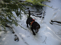
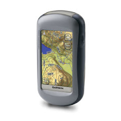
Training with Eagle Valley is always interesting. Many different problems are offered. In this instance Stryder, coming back after a bout with an enlarged prostate and thus getting neutered, started working on three simple human remain problems and did an excellent job. Remarks that I got were that Stryder seemed in very good shape and was ever so happy to work. He had good finds and refind and was ready for more, which he soon got, as in a slightly larger area and again he excelled in all parts of the exercise. The last hide was cut short as I needed to go back to the classroom to get ready for my presentation on GPS, this time mostly forcussed on the Garmin 60CSx.
Later on Stryder had a building problem. We used the dorm building and trailers, all used and heated so the scent picture was quite complex and there was a lot of residual scent from a previous hide spreading around. Stryder showed some frustration but I could still read him as he did not have a strong source of scent, and in the trailer where I figured by his behavior the person was hiding, he even showed more frustration, as he could not find the exact location of the person hiding, so I took him out of the direct scent cone, then he went back and indicated, but he never saw Jana, the subject behind the shower curtain, the scent coming down along the wall, yet trusted his nose and he was right as it brought him within inches of the unseen subject. It was interesting for me to watch and see him work the problem out. Actually I now realize that Stryder has had very little previous building search experience and none in lived-in buildings, so for a first experience, it was indeed a very good performance.
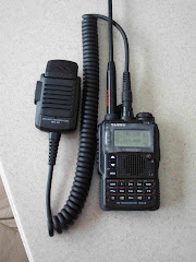
While all that was going on, I also deployed my APRS system consisting of the Yaesu VX-8 and the Kenwood TH-D7ag and Garmin 60CSx GPS. THis was the first time this system was depolyed not at home and it worked well, although I was never too far from base. I did not activate my Kenwood TM-D700 to repeat the signals as there was no APRS digi within range. Hopefully one of these days I'll be in range of such a digi.
We ended the day by following an urban trail in the village of Hanckock. Long trail, with many curve balls thrown by the fickle nature of scent and conditions.
I skipped dinner with the team as I had to drive home and did not want to drive tired and late at night.
Later on Stryder had a building problem. We used the dorm building and trailers, all used and heated so the scent picture was quite complex and there was a lot of residual scent from a previous hide spreading around. Stryder showed some frustration but I could still read him as he did not have a strong source of scent, and in the trailer where I figured by his behavior the person was hiding, he even showed more frustration, as he could not find the exact location of the person hiding, so I took him out of the direct scent cone, then he went back and indicated, but he never saw Jana, the subject behind the shower curtain, the scent coming down along the wall, yet trusted his nose and he was right as it brought him within inches of the unseen subject. It was interesting for me to watch and see him work the problem out. Actually I now realize that Stryder has had very little previous building search experience and none in lived-in buildings, so for a first experience, it was indeed a very good performance.
While all that was going on, I also deployed my APRS system consisting of the Yaesu VX-8 and the Kenwood TH-D7ag and Garmin 60CSx GPS. THis was the first time this system was depolyed not at home and it worked well, although I was never too far from base. I did not activate my Kenwood TM-D700 to repeat the signals as there was no APRS digi within range. Hopefully one of these days I'll be in range of such a digi.
We ended the day by following an urban trail in the village of Hanckock. Long trail, with many curve balls thrown by the fickle nature of scent and conditions.
I skipped dinner with the team as I had to drive home and did not want to drive tired and late at night.
DXCC progress
Well, it was time to have a look at my logs as I noticed that I have 55 confirmed entities with ARRL's Log of the World (LoTW). In addition, I have QSL cards for another 20 entities, so I'm three quarters of the way there in confirmed entities.
Checking my logs, I found another 28 entities so now I'm busy printing envelopes and filling-in the cards so hopefully, I will get replies and will be able to submit my claim for the DXCC, award for contacts with one hundred different entities and/or countries in the world.
UPDATE
Well the cards are slowly coming in. Seven were waiting for me upon returning from the trip to Panama. Then three more came on different days, and today three came together. One of the card I got was a return, addressee not known, but upon checking with QRZ, it appeared there was a problem with the PO.Box, so this card is back on its way to San Marino.
So for April 2nd, I have now 56 entities on LoTW, and 31 cards in hand for a total of 87 entities. Thirteen more to go and seventeen cards sent out that have not come back yet.
Well we are now May 10th and the score has improved but not yet there. I currently have 59 LoTW entities and 38 cards in hand, for a total of 97 confirmed entities. Three more to go...
May 14th, I'm getting closer yet with one more LoTW entity, so now it is 60 LoTW and 38 cards in hand... I worked a Grenada station on RTTY and this one is a LoTW user so I was really hoping to get a QSL. Well, it worked and now whether the card I sent for a previous contact in Grenada ever comes back is more academic, although I'd like to have it anyhow.
Well, I'll be giving preference to LoTW users by using programs such as LUQ which identify them and they will become just as attractive as rare DX stations. While the DXCC is a goal I'm about to achieve, I see it now only as a stepping stone to things bigger and better.
May 20th. I just got another LoTW confirmation, this time for Kenya so now I stand at 61 LoTW and 38 cards in hand for a total of 99 confirmed DXCC entities. Oh the wait for number 100 is going to be long...
Checking my logs, I found another 28 entities so now I'm busy printing envelopes and filling-in the cards so hopefully, I will get replies and will be able to submit my claim for the DXCC, award for contacts with one hundred different entities and/or countries in the world.
The ARRL DX Century Club Program
Once I get enough cards back to complete 100 entities, I will have to take them to a Field Checker to continue the application process.UPDATE
Well the cards are slowly coming in. Seven were waiting for me upon returning from the trip to Panama. Then three more came on different days, and today three came together. One of the card I got was a return, addressee not known, but upon checking with QRZ, it appeared there was a problem with the PO.Box, so this card is back on its way to San Marino.
So for April 2nd, I have now 56 entities on LoTW, and 31 cards in hand for a total of 87 entities. Thirteen more to go and seventeen cards sent out that have not come back yet.
Well we are now May 10th and the score has improved but not yet there. I currently have 59 LoTW entities and 38 cards in hand, for a total of 97 confirmed entities. Three more to go...
May 14th, I'm getting closer yet with one more LoTW entity, so now it is 60 LoTW and 38 cards in hand... I worked a Grenada station on RTTY and this one is a LoTW user so I was really hoping to get a QSL. Well, it worked and now whether the card I sent for a previous contact in Grenada ever comes back is more academic, although I'd like to have it anyhow.
Well, I'll be giving preference to LoTW users by using programs such as LUQ which identify them and they will become just as attractive as rare DX stations. While the DXCC is a goal I'm about to achieve, I see it now only as a stepping stone to things bigger and better.
May 20th. I just got another LoTW confirmation, this time for Kenya so now I stand at 61 LoTW and 38 cards in hand for a total of 99 confirmed DXCC entities. Oh the wait for number 100 is going to be long...
Friday, February 13, 2009
Made contact with K5D, DX expedition on Desecheo Island

February 13. 2009
Made contact with the K5D DX expedition over there.
Desecheo Island is located off Puerto Rico. It is a nature preserve and the Fish and Wildlife authorities don't allow people in there, so this DX expedition is a rare occasion to make contact with that particular location. It also gives me another entity towards my DXCC award given for confirmed contacts with at least 100 overseas entities and countries. Desecheo is the 6th most-needed DXCC entity world-wide! The 3rd most-needed DXCC entity in Europe! And the 2nd most-needed DXCC entity in Asia! So although it is not a very long distance call, 1,777 miles, it is an important contact for me. If you want to learn more about this DX expedition check out their webpage: http://www.kp5.us/
I worked my Icom 756ProIII, which is my main HF radio.

And here is a close up of the display.
 Now the operator of the Desecheo Island station K5D was operating on a split frequency, meaning he was transmitting on 18.145 MHz but listening anywhere between 18.150 to18.160, or 5 to 10 up in the ham lingo. The trick is to find what frequency K5D is actually listening to so you can tranmit on that particular frequency and make the call. Of course you need to also listen to his transmit frequency. Most HF radios allow you to do that but the Icom 756ProIII not only has a split mode, it has a dual watch which allows me to listen to two frequencies at a time. Yes, it takes some getting used to figure it out in your head, but it is like fishing , you need patience and slowly move the dial to where the large mountain is, where there is a lot of transmissions. Then you need to find the match between the station calling and K5D answering to that station. Now all you can do is hope a stronger station with n amplifier and a huge antenna is not going to walk over your own transmission. Patience and luck do it! I was very lucky and got through almost immediately after I found the listening frequency.
On the display, the white line by the "m" in spectrum indicates the frequency K5D is transmitting one and the red line the frequency I am transmitting on. Each hump indicates activity on that part of the band.
And below is the log excerpt of K5D showing the contact that I made. Now I'll try to make additional contacts in different bands.

Thursday, February 12, 2009
Kenwood TM-D700 digipeating my Yaesu VX-8
 While I'm very happy with my new Yaesu VX-8, I have noticed that even with an antenna better than the OEM, I rarely get my APRS signal into the local digipeaters. Well, today, that problem got solved. I set my truck's Kenwood TM-D700 to digipeat the VX-8 and it worked perfectly. Yes, I had a little path duplication that is now taken care of, but now the signal flow nicely. Of course, the purists will see a runner going quite faster than humans can, but with today's weather (rain and wet snow), I simply used it from inside the truck.
I now have a working system for SAR or other purposes where my VX-8 signal is digipeated by my truck and can be picked up by my Kenwood TH-D7ag/Garmin CSx at base etc. I can even leave the D7 on its charging stand and not worry about batteries going down.
The next step? Connecting the D7 to my laptop.


 I've also noticed that I prefer having the GPS affixed to my radio and not use the remote mike. The package is much more compact without the dangling mike, with the GPS in a place where sooner or later it will get banged hard. In addition, APRS needs to be supervised to look for messages, etc., so I have to look at the display anyhow. For now my VX-8 is configured as in the second picture.
So what can you learn about me through APRS? Well below is a Google map you can access through the links of this blog. It will not always be the same map, depending on where I went and if I turned the system on. But here it is. You may notice that the lines do not do right on the roads. This is simply because they join points taken at two minutes interval, if there was reception and do not show exactly where my truck went. Being a Google map, you can also flick it to the satellite picture, well the real think, not the screen dump I put here.
And finally, you can see the data, mainly the last coordinates, the date and time, first and last heard and the location details.
Try it, either on this blog or on my website.
Saturday, February 7, 2009

The red track was taken with my Garmin 60CSx and the blue one with my Garmin Oregon 400i. I was walking my dog. He was off lead and stopped a few times, well, he's a boy and needs to leave his business cards around... So I did have to make a few about faces in motion, just to check on him. I think those about faces show better in the Oregon track, but while I walked at night without a light, I don't think I was as jittery as the blue track shows me to have been. OTOH, I don't think I was as smooth as the red track. I tried walking in the middle of the road. As you can see, both tracks show me a little to the side, both being equally wrong, but by how much? The scale bar shows 300 feet! This is a narrow road where two vehicles can pass, but with care. So we are talking about a few feet, maybe ten or so. To me, both tracks are acceptable. Both GPS units were tracking with the same setup, by distance, a point every
Subscribe to:
Posts (Atom)